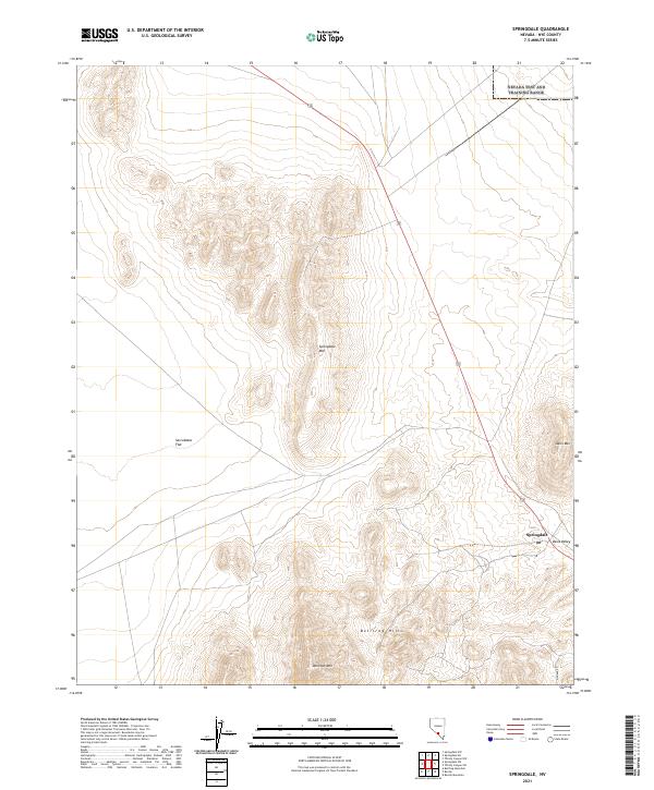
2021 Map of Springdale
USGS Topo · Published 2021About this map
Springdale and the Oasis Valley serve as the primary geographical focus in this high-desert portion of Nye County. The landscape is defined by the significant topographic rise of the Bullfrog Hills and Donovan Mtn to the south, contrasting with the wide expanse of Sarcobatus Flat in the west. These features outline a corridor of movement through the arid terrain, where the eponymous Springdale Mtn and Oasis Mtn flank the valley. This contemporary survey captures the sparse settlement patterns of the region, showing how human activity, represented by Pioneer Rd, is dictated by the dramatic shifts in elevation and the rare availability of valley resources. The land is strictly divided by township and range lines, including t10s r46e, which organize this rugged territory.
Find a feature on this map
14 named features on this map. Tap any name to fly to it.
Don’t see what you’re looking for? This feature index may not catch every label — zoom into the map to look around manually.
Map Details
Editions of this 2021 Springdale Map
This is the sole edition of this map. No revisions or reprints were ever made.
Other maps of this area

1908 · Kawich
USGS Topo · 1:250,000

1908 · Furnace Creek
USGS Topo · 1:250,000

1910 · Furnace Creek
USGS Topo · 1:250,000

1942 · Tolicha Peak
USGS Topo · 1:125,000

1942 · Bullfrog
USGS Topo · 1:125,000

1948 · Death Valley
USGS Topo · 1:250,000

1954 · Bare Mtn
USGS Topo · 1:62,500

1954 · Bullfrog
USGS Topo · 1:62,500

1954 · Death Valley
USGS Topo · 1:250,000

1954 · Goldfield
USGS Topo · 1:250,000