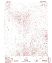
1986 Map of Springdale
USGS Topo · Published 1986About this map
Springdale lies within the Oasis Valley, representing a rare point of settlement in this arid reach of Nye County. The landscape is defined by the sharp rise of Springdale Mountain and the expansive Sarcobatus Flat to the west. Evidence of the region's transport history is found in the Old Railroad Grade that cuts across the northern desert floor, tracing a line toward the horizon. To the south, the Bullfrog Hills and Donovan Mountain rise above scattered mining signs, including a noted Prospect, while the northeast corner of the map is dominated by the Nellis Air Force Range. This 1980s provisional survey shows the stark division between the open public lands and the restricted military terrain, capturing the transition from the old rail-and-prospecting economy to the modern defense-oriented landscape.
Find a feature on this map
12 named features on this map. Tap any name to fly to it.
Don’t see what you’re looking for? This feature index may not catch every label — zoom into the map to look around manually.
Map Details
Editions of this 1986 Springdale Map
This is the sole edition of this map. No revisions or reprints were ever made.
Other maps of this area

1908 · Kawich
USGS Topo · 1:250,000

1908 · Furnace Creek
USGS Topo · 1:250,000

1910 · Furnace Creek
USGS Topo · 1:250,000

1942 · Tolicha Peak
USGS Topo · 1:125,000

1942 · Bullfrog
USGS Topo · 1:125,000

1948 · Death Valley
USGS Topo · 1:250,000

1954 · Bare Mtn
USGS Topo · 1:62,500

1954 · Bullfrog
USGS Topo · 1:62,500

1954 · Death Valley
USGS Topo · 1:250,000

1954 · Goldfield
USGS Topo · 1:250,000