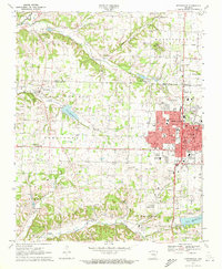
1970 Map of Springdale
USGS Topo · Published 1972About this map
Springdale anchors this Northwest Arkansas landscape as it underwent significant growth in the early 1970s. The city's expanding residential grid is shown in detail, reaching toward the Benton Co and Washington Co border. Educational and civic infrastructure is well-documented, featuring institutions such as Elmdale Sch, Central Jr High Sch, and the local Armory. The transportation network is defined by the St Louis-San Francisco railroad line, which skirts the eastern edge of the city near Bethel Heights.
Find a feature on this map
53 named features on this map. Tap any name to fly to it.
Don’t see what you’re looking for? This feature index may not catch every label — zoom into the map to look around manually.
Map Details
Editions of this 1970 Springdale Map
3 editions found
Other maps of this area

1899 · Fayetteville
USGS Topo · 1:125,000

1901 · Fayetteville
USGS Topo · 1:125,000

1904 · Fayetteville
USGS Topo · 1:125,000

1954 · Tulsa
USGS Topo · 1:250,000

1958 · Sonora
USGS Topo · 1:24,000

1958 · Rogers
USGS Topo · 1:24,000

1958 · Fayetteville
USGS Topo · 1:24,000

1958 · Elkins
USGS Topo · 1:24,000

1958 · Tulsa
USGS Topo · 1:250,000

1963 · Tulsa
USGS Topo · 1:250,000