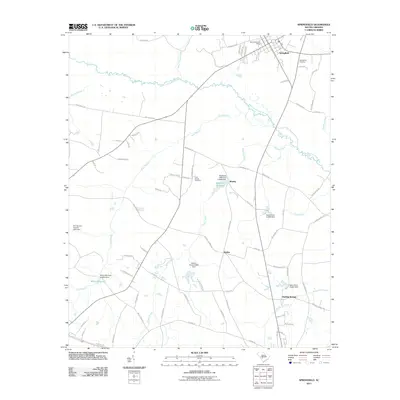
2011 Map of Springfield
USGS Topo · Published 2011About this map
The South Fork Edisto River winds through the northern portion of this South Carolina landscape, defining the rural character of the area around the town of Springfield. The town serves as a local hub, featuring the Springfield Post Office and the Springfield Cemetery. To the south, the landscape is dotted with several small impoundments and water bodies, reflecting a history of local water management and milling. Notable features include Matthews Millpond and Willis Millpond, each supported by historically significant dams like the Willis Mill Pond D-3054 Dam. Small settlements such as Whaley, Walker, and the aptly named Healing Springs are connected by a network of local routes like Whaley Rd and Jones Bridge Rd. This survey captures a region where agriculture and natural hydrology intersect, from the banks of Dean Swamp Creek to the various branches that feed into the main river system.
Find a feature on this map
78 named features on this map. Tap any name to fly to it.
Don’t see what you’re looking for? This feature index may not catch every label — zoom into the map to look around manually.
Map Details
Editions of this 2011 Springfield Map
This is the sole edition of this map. No revisions or reprints were ever made.
Other maps of this area

1919 · Bamberg
USGS Topo · 1:48,000

1920 · Bamberg
USGS Topo · 1:62,500

1923 · Williston
USGS Topo · 1:48,000

1927 · Williston
USGS Topo · 1:62,500

1943 · Bamberg
USGS Topo · 1:62,500

1943 · Williston
USGS Topo · 1:62,500

1944 · Seivern
USGS Topo · 1:62,500

1946 · Woodford
USGS Topo · 1:62,500

1954 · Augusta
USGS Topo · 1:250,000

1957 · Augusta
USGS Topo · 1:250,000