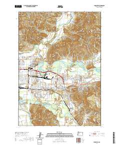
2020 Map of Springfield
USGS Topo · Published 2020About this map
Springfield and the adjacent community of Thurston are situated at a complex hydrological junction where the Mohawk River and McKenzie River meet the valley floor. This 2020 survey details the extensive residential and industrial development south of Coburg Ridge, reaching toward the prominent elevation of Mt Pisgah. The map reveals a landscape deeply connected to local history and timber legacy, evidenced by features like the Smith Weyerhauser Cem and Jasper-Wallace Cem. Significant water management is visible through numerous sloughs and creeks, including Irving Slough and Kizer Slough, which weave through the suburban landscape. For researchers, the map provides precise locations for family history sites like Stafford Cem and Mount Vernon Cem, alongside aviation landmarks such as the Jasper Ridge Airstrip at the southern edge of the quadrangle.
Find a feature on this map
84 named features on this map. Tap any name to fly to it.
Don’t see what you’re looking for? This feature index may not catch every label — zoom into the map to look around manually.
Map Details
Editions of this 2020 Springfield Map
This is the sole edition of this map. No revisions or reprints were ever made.
Other maps of this area

1910 · Eugene
USGS Topo · 1:62,500

1921 · Cottage Grove
USGS Topo · 1:62,500

1935 · Lowell
USGS Topo · 1:96,000

1940 · Eugene
USGS Topo · 1:62,500

1942 · Lowell
USGS Topo · 1:125,000

1946 · Eugene
USGS Topo · 1:62,500

1949 · Eugene
USGS Topo · 1:62,500

1950 · Marcola
USGS Topo · 1:62,500

1952 · Marcola
USGS Topo · 1:62,500

1953 · Salem
USGS Topo · 1:250,000