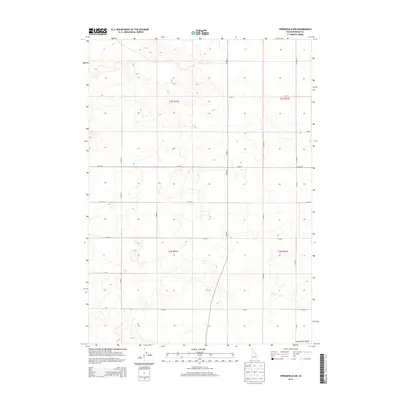
2013 Map of Springfield NW
USGS Topo · Published 2013About this map
The Snake River Valley defines the topography of this Bingham County landscape, where the land is organized by a precise grid of rural roads and irrigation infrastructure. The most prominent water feature is the Rockford Canal, which flows through the southeastern portion of the quadrangle, reflecting the area's reliance on managed water systems for agriculture. A network of arterial routes, including Hoff Rd, W Hoff Rd, and W 400 S, provides access to the large sections of the t2s r32e and t3s r32e townships. The map illustrates a largely open terrain typical of the Snake River Plain, where human presence is marked primarily by the geometric precision of the S 2200 W and N 1900 W corridors.
Find a feature on this map
23 named features on this map. Tap any name to fly to it.
Don’t see what you’re looking for? This feature index may not catch every label — zoom into the map to look around manually.
Map Details
Editions of this 2013 Springfield NW Map
This is the sole edition of this map. No revisions or reprints were ever made.
Other maps of this area

1955 · Springfield NW
USGS Topo · 1:24,000

1955 · Rockford
USGS Topo · 1:24,000

1955 · Pingree
USGS Topo · 1:24,000

1955 · Springfield
USGS Topo · 1:24,000

1955 · Idaho Falls
USGS Topo · 1:250,000

1958 · Idaho Falls
USGS Topo · 1:250,000

1973 · Olsen
USGS Topo · 1:24,000

1973 · Taber
USGS Topo · 1:24,000

1973 · Lava Lake Reservoir
USGS Topo · 1:24,000

1973 · Coffee Point NE
USGS Topo · 1:24,000