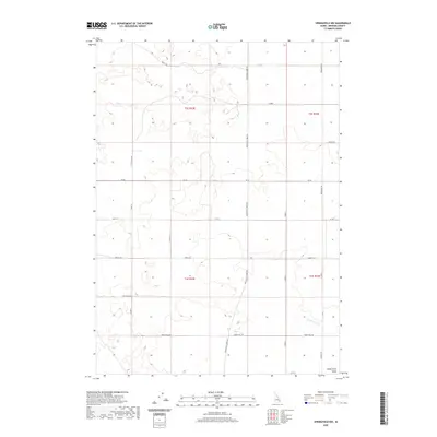
2020 Map of Springfield NW
USGS Topo · Published 2020About this map
The Snake River Valley defines the lower reaches of this Bingham County landscape, where the agricultural geometry of the Eastern Snake River Plain is clearly visible. The southern portion of the map is marked by the vital irrigation infrastructure of the Rockford Canal, a key feature for the regional farming economy. A dense grid of section-line roads and named tracks, such as Springfield Taber Rd and Monument Rd, organizes the territory into the standard Public Land Survey System townships of T2S and T3S. Historically significant routes like Sheep Trail Rd cut across the landscape, reflecting the movement of livestock and the development of local transport networks. The terrain is characterized by subtle elevation changes and depressions, typical of the volcanic and alluvial processes that shaped this part of Idaho, providing a detailed look at the rural infrastructure and land use in the early twenty-first century.
Find a feature on this map
25 named features on this map. Tap any name to fly to it.
Don’t see what you’re looking for? This feature index may not catch every label — zoom into the map to look around manually.
Map Details
Editions of this 2020 Springfield NW Map
This is the sole edition of this map. No revisions or reprints were ever made.
Other maps of this area

1955 · Springfield NW
USGS Topo · 1:24,000

1955 · Rockford
USGS Topo · 1:24,000

1955 · Pingree
USGS Topo · 1:24,000

1955 · Springfield
USGS Topo · 1:24,000

1955 · Idaho Falls
USGS Topo · 1:250,000

1958 · Idaho Falls
USGS Topo · 1:250,000

1973 · Olsen
USGS Topo · 1:24,000

1973 · Taber
USGS Topo · 1:24,000

1973 · Lava Lake Reservoir
USGS Topo · 1:24,000

1973 · Coffee Point NE
USGS Topo · 1:24,000