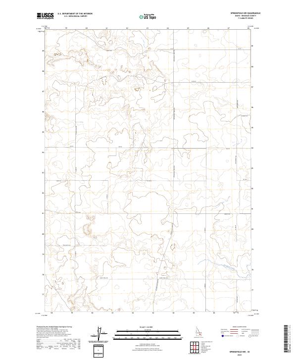
2023 Map of Springfield NW
USGS Topo · Published 2023About this map
Rockford Canal carves through the southeastern corner of this Bingham County landscape, marking one of the few distinct water features in an area otherwise defined by its agricultural grid and desert terrain. The map reveals a highly structured network of section lines and irrigation-influenced infrastructure, where long straightaways like Springfield Taber Rd and Monument RD dictate the movement across the Snake River Plain. This 2023 survey illustrates the modern layout of rural Idaho land divisions, where access routes such as Sheep Trail Rd and Well 2 Rd highlight the enduring importance of water management and livestock movement. The surrounding road network, including Clover Club Rd and Droghie Rd, connects isolated ranching interests and agricultural tracts within the larger township boundaries of T2S and T3S.
Find a feature on this map
22 named features on this map. Tap any name to fly to it.
Don’t see what you’re looking for? This feature index may not catch every label — zoom into the map to look around manually.
Map Details
Editions of this 2023 Springfield NW Map
This is the sole edition of this map. No revisions or reprints were ever made.
Other maps of this area

1955 · Springfield NW
USGS Topo · 1:24,000

1955 · Rockford
USGS Topo · 1:24,000

1955 · Pingree
USGS Topo · 1:24,000

1955 · Springfield
USGS Topo · 1:24,000

1955 · Idaho Falls
USGS Topo · 1:250,000

1958 · Idaho Falls
USGS Topo · 1:250,000

1973 · Olsen
USGS Topo · 1:24,000

1973 · Taber
USGS Topo · 1:24,000

1973 · Lava Lake Reservoir
USGS Topo · 1:24,000

1973 · Coffee Point NE
USGS Topo · 1:24,000