
1956 Map of Springfield
USGS Topo · Published 1957About this map
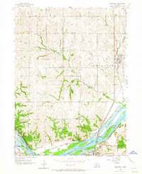
The Platte River defines the southern boundary of this mid-1950s survey, marking the transition between Sarpy and Cass counties. Along its northern banks, a dense network of transportation infrastructure reveals the area's role as a transit corridor, featuring the Missouri Pacific and Chicago Rock Island and Pacific railroads. The town of Springfield serves as a northern hub, while Louisville and the small settlement of Meadow anchor the riverfront.
Find a feature on this map
33 named features on this map. Tap any name to fly to it.
Don’t see what you’re looking for? This feature index may not catch every label — zoom into the map to look around manually.
Map Details
Editions of this 1956 Springfield Map
4 editions found
Other maps of this area

1893 · Fremont
USGS Topo · 1:125,000

1896 · Fremont
USGS Topo · 1:125,000

1903 · Weeping Water
USGS Topo · 1:125,000

1929 · Weeping Water
USGS Topo · 1:125,000

1955 · Fremont
USGS Topo · 1:250,000

1955 · Lincoln
USGS Topo · 1:250,000

1956 · Gretna
USGS Topo · 1:24,000

1956 · Cedar Creek
USGS Topo · 1:24,000

1956 · Ralston
USGS Topo · 1:24,000
1956 · Weeping Water NE
USGS Topo · 1:24,000