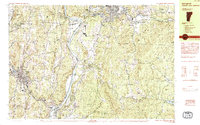
1984 Map of Springfield
USGS Topo · Published 1984About this map
The Connecticut River serves as the focal point of this 1980s landscape, defining the state boundary between Springfield, Vermont, and the surrounding New Hampshire townships of Charlestown and Claremont. The industrial and transport history of the Upper Valley is evident in the convergence of the Boston and Maine RR and the Claremont and Concord RR near Springfield Junction. Settlements like Weathersfield Bow and North Charlestown are depicted alongside local landmarks such as Goulds Mill and the Claremont Airport.
Find a feature on this map
84 named features on this map. Tap any name to fly to it.
Don’t see what you’re looking for? This feature index may not catch every label — zoom into the map to look around manually.
Map Details
Editions of this 1984 Springfield Map
This is the sole edition of this map. No revisions or reprints were ever made.
Other maps of this area

1902 · Sunapee
USGS Topo · 1:62,500

1905 · Sunapee
USGS Topo · 1:62,500

1907 · Sunapee
USGS Topo · 1:62,500

1926 · Claremont
USGS Topo · 1:62,500

1927 · Bellows Falls
USGS Topo · 1:48,000

1928 · Ludlow
USGS Topo · 1:48,000

1929 · Claremont
USGS Topo · 1:62,500

1929 · Ludlow
USGS Topo · 1:62,500

1930 · Saxtons River
USGS Topo · 1:48,000

1930 · Lovewell Mountain
USGS Topo · 1:62,500