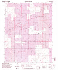
1996 Map of Springfield SW
USGS Topo · Published 2000About this map
The Comanche National Grassland dominates this corner of Baca County, where the high plains landscape is defined by vast open ranges and the sparse network of water sources essential for livestock and agriculture. At the western edge, the Colorado State University Experiment Station highlights the regional focus on dryland farming and agricultural research. The small settlement of Liberty sits along a north-south roadway, serving as a rare focal point for human activity in a territory primarily marked by windmills and named water features.
Find a feature on this map
9 named features on this map. Tap any name to fly to it.
Don’t see what you’re looking for? This feature index may not catch every label — zoom into the map to look around manually.
Map Details
Editions of this 1996 Springfield SW Map
2 editions found
Other maps of this area

1891 · Springfield
USGS Topo · 1:125,000

1893 · Springfield
USGS Topo · 1:125,000

1955 · La Junta
USGS Topo · 1:250,000

1958 · La Junta
USGS Topo · 1:250,000

1968 · La Junta
USGS Topo · 1:250,000

1978 · Edler
USGS Topo · 1:24,000

1978 · Pritchett
USGS Topo · 1:24,000

1978 · Springfield SW
USGS Topo · 1:24,000

1978 · Campo NE
USGS Topo · 1:24,000
1978 · Harbord
USGS Topo · 1:24,000