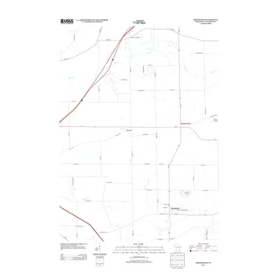
2013 Map of Springfield
USGS Topo · Published 2013About this map
Springfield and Spring Prairie anchor this corner of Walworth County, where the agricultural landscape is defined by the winding paths of Sugar Cr and Ore Cr. The settlement of Bowers lies central to the quadrangle, connected by a network of rural roads that intersect near Bowers Rd. This 2013 survey reveals a notable concentration of private aviation infrastructure, including Barker Strip Airport and Plows & Props Airport, reflecting the region's flat, open topography and its history of local airfields. The southern portion of the map is marked by the presence of Lakeland Hospital and the White River, while the northern reaches are dominated by the interstate corridor and the meandering course of Jackson Cr. Local road names such as Scotch Bush Rd and Hodunk Rd provide clear markers for genealogists and local historians tracking family land and early transportation routes.
Find a feature on this map
48 named features on this map. Tap any name to fly to it.
Don’t see what you’re looking for? This feature index may not catch every label — zoom into the map to look around manually.
Map Details
Editions of this 2013 Springfield Map
This is the sole edition of this map. No revisions or reprints were ever made.
Other maps of this area

1892 · Whitewater
USGS Topo · 1:62,500

1892 · Eagle
USGS Topo · 1:62,500

1893 · Delavan
USGS Topo · 1:62,500

1893 · Whitewater
USGS Topo · 1:62,500

1893 · Geneva
USGS Topo · 1:62,500

1894 · Eagle
USGS Topo · 1:62,500

1897 · Eagle
USGS Topo · 1:62,500

1903 · Whitewater
USGS Topo · 1:62,500

1904 · Lake Geneva
USGS Topo · 1:62,500

1906 · Eagle
USGS Topo · 1:62,500