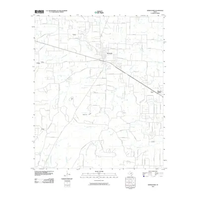
2010 Map of Springtown
USGS Topo · Published 2010About this map
Springtown serves as the central hub for this corner of Parker County, where a network of rural roads like Goshen Rd and Walnut Creek Dr connect outlying agricultural and residential areas. The landscape is defined by the numerous watercourses that drain the region, including Walnut Creek, Goshen Creek, and Browders Creek. Local topographic landmarks provide a sense of place, from the elevation of Tater Hill to the curiously named Hangmans Hollow along Lick Branch.
Find a feature on this map
80 named features on this map. Tap any name to fly to it.
Don’t see what you’re looking for? This feature index may not catch every label — zoom into the map to look around manually.
Map Details
Editions of this 2010 Springtown Map
This is the sole edition of this map. No revisions or reprints were ever made.
Other maps of this area

1891 · Weatherford
USGS Topo · 1:125,000

1893 · Weatherford
USGS Topo · 1:125,000

1924 · Sunset 4-d
USGS Topo · 1:48,000

1930 · Boyd
USGS Topo · 1:62,500

1932 · Springtown
USGS Topo · 1:62,500

1954 · Dallas
USGS Topo · 1:250,000

1954 · Sherman
USGS Topo · 1:250,000

1955 · Azle
USGS Topo · 1:24,000
1955 · Springtown SE
USGS Topo · 1:24,000

1958 · Dallas
USGS Topo · 1:250,000