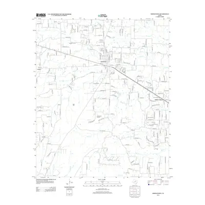
2012 Map of Springtown
USGS Topo · Published 2012About this map
Springtown anchors this North Texas landscape, where residential development and oil extraction meet the drainage basins of the Trinity River tributaries. The map documents the city's street grid and the nearby Highland Addition, alongside agricultural land and the Springtown Oil Field. The terrain is characterized by numerous small watercourses, including Walnut Cr, Browders Cr, and Woody Cr, which carve through the countryside near local landmarks like Tater Hill and the ominously named Hangmans Hollow.
Find a feature on this map
201 named features on this map. Tap any name to fly to it.
Don’t see what you’re looking for? This feature index may not catch every label — zoom into the map to look around manually.
Map Details
Editions of this 2012 Springtown Map
This is the sole edition of this map. No revisions or reprints were ever made.
Other maps of this area

1891 · Weatherford
USGS Topo · 1:125,000

1893 · Weatherford
USGS Topo · 1:125,000

1924 · Sunset 4-d
USGS Topo · 1:48,000

1930 · Boyd
USGS Topo · 1:62,500

1932 · Springtown
USGS Topo · 1:62,500

1954 · Dallas
USGS Topo · 1:250,000

1954 · Sherman
USGS Topo · 1:250,000

1955 · Azle
USGS Topo · 1:24,000
1955 · Springtown SE
USGS Topo · 1:24,000

1958 · Dallas
USGS Topo · 1:250,000