
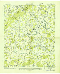
1935 Map of Springvale
USGS Topo · Published 1935About this map
The Nolichucky River carves a winding path through this landscape, marking the historical boundaries between Hamblen, Greene, and Cocke counties. In 1935, the river was a primary corridor of transport and utility, evidenced by the Susong Bridge, Jones Bridge, and crossing points like Inman Ford and Cane Ford. The Southern Railway runs parallel to several watercourses, linking rural settlements such as Susong and Springvale to the wider region.
Find a feature on this map
57 named features on this map. Tap any name to fly to it.
Don’t see what you’re looking for? This feature index may not catch every label — zoom into the map to look around manually.
Map Details
Editions of this 1935 Springvale Map
This is the sole edition of this map. No revisions or reprints were ever made.
Other maps of this area

1883 · Morristown
USGS Topo · 1:125,000

1893 · Morristown
USGS Topo · 1:125,000

1895 · Morristown
USGS Topo · 1:125,000

1935 · White Pine
USGS Topo · 1:24,000

1935 · Rogersville
USGS Topo · 1:48,000

1935 · Tate Springs
USGS Topo · 1:48,000

1935 · Parrottsville
USGS Topo · 1:24,000

1935 · Morristown
USGS Topo · 1:24,000

1935 · Russellville
USGS Topo · 1:24,000
1935 · Mohawk
USGS Topo · 1:24,000