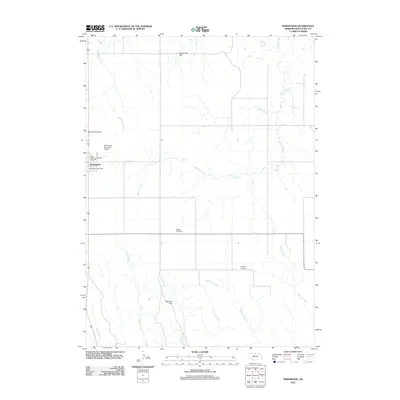
2011 Map of Springview
USGS Topo · Published 2011About this map
Springview serves as the central hub for this High Plains landscape, situated at the junction of local transit routes such as Co RD 1720. The town is the site of essential local institutions, including the Springview Post Office, the Springview Municipal Airport, and the Keya Paha County Fair Grounds. This 2011 survey details a region defined by its reliance on intermittent water sources and high-ground landmarks. The drainage network is particularly dense here, with Burton Creek and East Holt Creek carving paths through the terrain near notable elevations like Sugarloaf Hill and McClain Hill. For those tracing local families, the map identifies three distinct burial grounds: Mount Hope Cemetery to the north, Rogers Cemetery centrally, and Highland Cemetery further south, providing a spatial record of the community's rural settlement patterns.
Find a feature on this map
18 named features on this map. Tap any name to fly to it.
Don’t see what you’re looking for? This feature index may not catch every label — zoom into the map to look around manually.
Map Details
Editions of this 2011 Springview Map
This is the sole edition of this map. No revisions or reprints were ever made.
Other maps of this area

1949 · Dutch Creek
USGS Topo · 1:24,000

1949 · Riverview
USGS Topo · 1:24,000

1950 · Bassett NW
USGS Topo · 1:24,000

1950 · Riverview
USGS Topo · 1:24,000

1950 · Meadville
USGS Topo · 1:24,000

1950 · Dutch Creek
USGS Topo · 1:24,000

1955 · O'Neill
USGS Topo · 1:250,000

1959 · O'Neill
USGS Topo · 1:250,000
1964 · Springview
USGS Topo · 1:24,000
1964 · Burton
USGS Topo · 1:24,000