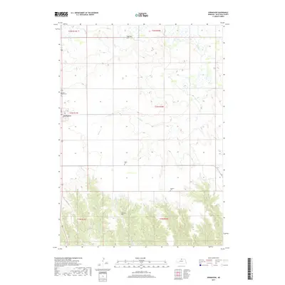
2017 Map of Springview
USGS Topo · Published 2017About this map
Springview serves as the central hub of this Keya Paha County landscape, where the town grid is anchored by N Main St. The surrounding terrain is defined by a network of drainage systems, including Burton Cr and Thomas Cr, which carve through the high plains. Significant local landmarks such as Sugarloaf Hill and McClain Hill rise above the drainage basins, offering clear topographic markers in an area primarily dedicated to agriculture and ranching.
Find a feature on this map
17 named features on this map. Tap any name to fly to it.
Don’t see what you’re looking for? This feature index may not catch every label — zoom into the map to look around manually.
Map Details
Editions of this 2017 Springview Map
This is the sole edition of this map. No revisions or reprints were ever made.
Other maps of this area
1949 · Dutch Creek
USGS Topo · 1:24,000
1949 · Riverview
USGS Topo · 1:24,000
1950 · Bassett NW
USGS Topo · 1:24,000
1950 · Riverview
USGS Topo · 1:24,000
1950 · Meadville
USGS Topo · 1:24,000
1950 · Dutch Creek
USGS Topo · 1:24,000
1955 · O'Neill
USGS Topo · 1:250,000
1959 · O'Neill
USGS Topo · 1:250,000
1964 · Springview
USGS Topo · 1:24,000
1964 · Burton
USGS Topo · 1:24,000