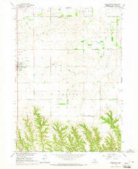
1964 Map of Springview
USGS Topo · Published 1965About this map
Springview serves as the central hub of this Keya Paha County landscape during the mid-1960s, situated on a high plateau above an intricate network of drainage systems. The northern portion of the map is defined by the open country of Burton and Custer precincts, where rural life is anchored by family-named landmarks and essential community institutions like Green Valley Sch. Genealogists will find a high concentration of burial sites across the township lines, including Sugarloaf Hill Cem, Mount Hope Cem, Rogers Cem, and Highland Cem.
Find a feature on this map
24 named features on this map. Tap any name to fly to it.
Don’t see what you’re looking for? This feature index may not catch every label — zoom into the map to look around manually.
Map Details
Editions of this 1964 Springview Map
This is the sole edition of this map. No revisions or reprints were ever made.
Other maps of this area

1949 · Dutch Creek
USGS Topo · 1:24,000

1949 · Riverview
USGS Topo · 1:24,000

1950 · Bassett NW
USGS Topo · 1:24,000

1950 · Riverview
USGS Topo · 1:24,000

1950 · Meadville
USGS Topo · 1:24,000

1950 · Dutch Creek
USGS Topo · 1:24,000

1955 · O'Neill
USGS Topo · 1:250,000

1959 · O'Neill
USGS Topo · 1:250,000
1964 · Burton
USGS Topo · 1:24,000
1964 · Springview SE
USGS Topo · 1:24,000