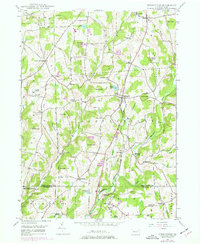
1946 Map of Springville
USGS Topo · Published 1977About this map
The Lehigh Valley railroad cuts through the heart of Susquehanna County in the 1940s, connecting small agricultural and milling hubs across a landscape of high ridges and deep valleys. The village of Springville serves as a central point, surrounded by smaller named settlements and crossroad hamlets like Auburn Four Corners, Kasson Corners, and Lymanville. Industrial and transit history is visible in the placement of Dimock Sta and Lynn Sta, which were vital links for local trade and transport before the mid-century expansion of roads.
Find a feature on this map
60 named features on this map. Tap any name to fly to it.
Don’t see what you’re looking for? This feature index may not catch every label — zoom into the map to look around manually.
Map Details
Editions of this 1946 Springville Map
2 editions found
Other maps of this area

1943 · Montrose
USGS Topo · 1:62,500

1943 · Le Raysville
USGS Topo · 1:62,500

1945 · Montrose
USGS Topo · 1:62,500

1945 · Le Raysville
USGS Topo · 1:62,500

1945 · Meshoppen
USGS Topo · 1:62,500

1945 · Auburn Center
USGS Topo · 1:24,000

1945 · Meshoppen
USGS Topo · 1:24,000

1946 · Tunkhannock
USGS Topo · 1:62,500

1946 · Factoryville
USGS Topo · 1:24,000

1946 · Springville
USGS Topo · 1:24,000