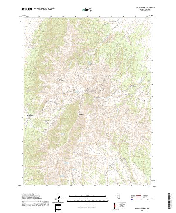
2021 Map of Spruce Mountain
USGS Topo · Published 2021About this map
Spruce Mtn dominates this Elko County landscape, serving as the high point for a network of drainages and critical water sources in the high desert. The small settlement of Sprucemont sits on the western slopes, connected by a series of Bureau of Land Management routes including BLM RD 1527 and BLM RD 1526. The map is particularly notable for its high density of named springs, which were essential for early mining and ranching operations in this arid region. From Townsite Spring near the settlement to the high-elevation Upper Latham Spring, these water features dictate the human footprint on the land. To the south, a cluster of watering points including Bosco Spring Number One, Bosco Spring Number Two, and Basco Spring highlight the importance of these sites for livestock and survival in the eastern Nevada wilderness.
Find a feature on this map
28 named features on this map. Tap any name to fly to it.
Don’t see what you’re looking for? This feature index may not catch every label — zoom into the map to look around manually.
Map Details
Editions of this 2021 Spruce Mountain Map
This is the sole edition of this map. No revisions or reprints were ever made.
Other maps of this area

1953 · Spruce Mountain
USGS Topo · 1:62,500

1953 · Spruce Mountain 4
USGS Topo · 1:62,500

1955 · Elko
USGS Topo · 1:250,000

1958 · Elko
USGS Topo · 1:250,000

1962 · Elko
USGS Topo · 1:250,000

1965 · Elko
USGS Topo · 1:250,000

1982 · Mizpah
USGS Topo · 1:24,000
1984 · Palomino Well
USGS Topo · 1:24,000
1984 · Palomino Ridge
USGS Topo · 1:24,000
1985 · Wendover
USGS Topo · 1:100,000