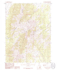
1986 Map of Spruce Mountain
USGS Topo · Published 1986About this map
Spruce Mountain dominates this Nevada landscape, where the high peaks of the Spruce Mountain Ridge are etched with the remnants of industrial exploration. This 1986 survey records a high concentration of mineral prospecting, evidenced by numerous labels for Mine Shaft, Prospect, and Pit scattered across the steep slopes. The distribution of these workings relative to water sources like Townsite Spring suggests a history of localized mining camps and high-altitude operations where water was a critical resource.
Find a feature on this map
16 named features on this map. Tap any name to fly to it.
Don’t see what you’re looking for? This feature index may not catch every label — zoom into the map to look around manually.
Map Details
Editions of this 1986 Spruce Mountain Map
This is the sole edition of this map. No revisions or reprints were ever made.
Other maps of this area

1953 · Spruce Mountain
USGS Topo · 1:62,500

1953 · Spruce Mountain 4
USGS Topo · 1:62,500

1955 · Elko
USGS Topo · 1:250,000

1958 · Elko
USGS Topo · 1:250,000

1962 · Elko
USGS Topo · 1:250,000

1965 · Elko
USGS Topo · 1:250,000

1982 · Mizpah
USGS Topo · 1:24,000
1984 · Palomino Well
USGS Topo · 1:24,000
1984 · Palomino Ridge
USGS Topo · 1:24,000
1985 · Wendover
USGS Topo · 1:100,000