
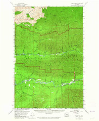
1956 Map of Spruce Mtn.
USGS Topo · Published 1960About this map
Huelsdonk Ranch and the nearby Huelsdonk Bridge stand as prominent markers of settlement along the riverbanks in the Upper Hoh Valley during the mid-1950s. This survey reveals a landscape defined by the parallel drainage of the Hoh River, Bogachiel River, Calawah River, and Sitkum River. While the northern and central portions of the map are protected within the Olympic National Forest and Olympic National Park, the southern river valleys show the encroachment of local infrastructure, including family-named sites like Schmidt Ranch and Lewis Ranch.
Find a feature on this map
53 named features on this map. Tap any name to fly to it.
Don’t see what you’re looking for? This feature index may not catch every label — zoom into the map to look around manually.
Map Details
Editions of this 1956 Spruce Mtn. Map
3 editions found
Other maps of this area

1918 · Lake Crescent
USGS Topo · 1:62,500

1922 · Pysht
USGS Topo · 1:62,500

1922 · Lake Crescent
USGS Topo · 1:62,500

1935 · Lake Pleasant
USGS Topo · 1:62,500

1939 · Forks
USGS Topo · 1:62,500

1939 · Mount Tom
USGS Topo · 1:62,500

1942 · Pysht
USGS Topo · 1:62,500

1942 · Lake Pleasant
USGS Topo · 1:62,500

1943 · Spruce Mountain
USGS Topo · 1:62,500

1943 · Copalis Beach
USGS Topo · 1:250,000