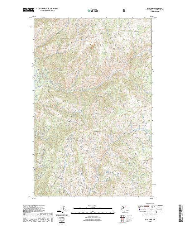
2023 Map of Spur Peak
USGS Topo · Published 2023About this map
Okanogan National Forest encompasses this high mountain landscape, where the Chewuch River cuts through the western edge of the terrain. The topography is defined by significant elevations like South Twentymile Peak and the namesake Spur Peak to the southeast. A network of alpine drainages including Twentymile Creek, North Fork Boulder Creek, and Junior Creek carve through the steep slopes, illustrating the complex hydrography of the Cascades region.
Find a feature on this map
26 named features on this map. Tap any name to fly to it.
Don’t see what you’re looking for? This feature index may not catch every label — zoom into the map to look around manually.
Map Details
Editions of this 2023 Spur Peak Map
This is the sole edition of this map. No revisions or reprints were ever made.
Other maps of this area

1906 · Chopaka
USGS Topo · 1:125,000

1954 · Okanogan
USGS Topo · 1:250,000

1955 · Concrete
USGS Topo · 1:250,000

1956 · Tiffany Mountain
USGS Topo · 1:62,500

1956 · Horseshoe Basin
USGS Topo · 1:62,500

1958 · Concrete
USGS Topo · 1:250,000

1958 · Okanogan
USGS Topo · 1:250,000

1962 · Concrete
USGS Topo · 1:250,000

1963 · Doe Mountain
USGS Topo · 1:62,500

1969 · Mt. Barney
USGS Topo · 1:24,000