
1968 Map of Spur SW
USGS Topo · Published 1970About this map
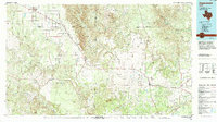
The Salt Fork Brazos River carves a deep path through the southeastern corner of this Kent County landscape, joined by the winding White River in a territory defined by high mesas and canyon-like drainage patterns. Cattle ranching and mineral exploration anchor the local economy, evidenced by family holdings like the Godfrey Ranch and Morrison Ranch alongside numerous Oil Wells and a specific Drill Hole scattered across the flats. The complex hydrology of the region is visible in the confluence of Red Mud Creek, Little Red Mud Creek, and Spring Creek, which navigate the broken ground between open range and the river breaks. A local electrical Substation and a network of unimproved roads provide the primary infrastructure for this ranching district, illustrating the mid-century development of the Rolling Plains.
Find a feature on this map
12 named features on this map. Tap any name to fly to it.
Don’t see what you’re looking for? This feature index may not catch every label — zoom into the map to look around manually.
Map Details
Editions of this 1968 Spur SW Map
This is the sole edition of this map. No revisions or reprints were ever made.
Other maps of this area

1954 · Lubbock
USGS Topo · 1:250,000

1962 · Twomile Creek
USGS Topo · 1:24,000

1962 · Smith Tank
USGS Topo · 1:24,000

1967 · Spur
USGS Topo · 1:24,000

1967 · Spur NW
USGS Topo · 1:24,000

1968 · White Camp
USGS Topo · 1:24,000

1969 · Cottonwood Creek
USGS Topo · 1:24,000

1969 · Clairemont West
USGS Topo · 1:24,000

1969 · T-O Creek
USGS Topo · 1:24,000
1985 · Aspermont
USGS Topo · 1:100,000