
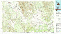
1968 Map of White Camp
USGS Topo · Published 1970About this map
Salt Fork Brazos River winds through the southwestern corner of this West Texas landscape, cutting deep into the terrain as it flows toward the more level plains to the east. This 1968 field-checked survey reveals the rural character of Kent County, centered on the settlement of White Camp. The mapping shows a landscape of braided creek beds and seasonal drainages, where Red Mud Cr and West Prong Duck Creek define the local hydrology. Cultural landmarks are sparse but significant for local history, including the Antelope Church in the northeast and various Well sites that signify the importance of water and resource extraction in this arid environment. The map captures a moment when fence lines and unimproved roads were the primary markers of human division across the rolling ranch land.
Find a feature on this map
8 named features on this map. Tap any name to fly to it.
Don’t see what you’re looking for? This feature index may not catch every label — zoom into the map to look around manually.
Map Details
Editions of this 1968 White Camp Map
This is the sole edition of this map. No revisions or reprints were ever made.
Other maps of this area

1954 · Lubbock
USGS Topo · 1:250,000

1959 · Gilpin
USGS Topo · 1:24,000

1959 · Girard
USGS Topo · 1:24,000

1967 · Spur
USGS Topo · 1:24,000

1967 · Spur NW
USGS Topo · 1:24,000

1968 · Spur SW
USGS Topo · 1:24,000

1969 · Clairemont East
USGS Topo · 1:24,000

1969 · Clairemont West
USGS Topo · 1:24,000

1969 · T-O Creek
USGS Topo · 1:24,000
1985 · Aspermont
USGS Topo · 1:100,000