
1952 Map of Spyrock
USGS Topo · Published 1954About this map
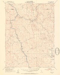
Round Valley Indian Reservation dominates the landscape of this mid-century survey, with the town of Covelo serving as a focal point in the broad valley floor. The Eel River and its North Fork carve deep canyons through the mountainous terrain, followed closely by the winding route of the Northwestern Pacific railroad. Small, isolated settlements like Nashmead, Spyrock, and Mina are positioned at intervals along the rail line and river, marking important transit points for the remote ranching and timber country. Higher elevations are characterized by significant landmarks such as Updegraff Ridge and Pookkinny Ridge, while early educational infrastructure is represented by the remote Lake Mtn Sch. The map records a complex network of creeks, including Shell Rock Creek and Woodman Creek, that define the drainage basins of the Mendocino and Trinity county borderlands.
Find a feature on this map
52 named features on this map. Tap any name to fly to it.
Don’t see what you’re looking for? This feature index may not catch every label — zoom into the map to look around manually.
Map Details
Editions of this 1952 Spyrock Map
4 editions found
Other maps of this area

1920 · Cummings
USGS Topo · 1:62,500

1920 · Covelo
USGS Topo · 1:62,500

1920 · Harris
USGS Topo · 1:62,500

1921 · Branscomb
USGS Topo · 1:62,500

1921 · Hoaglin
USGS Topo · 1:62,500

1922 · Island Mountain
USGS Topo · 1:62,500

1926 · Covelo
USGS Topo · 1:62,500

1929 · Eden Valley
USGS Topo · 1:62,500

1931 · Hoaglin
USGS Topo · 1:96,000

1935 · Hoaglin
USGS Topo · 1:125,000