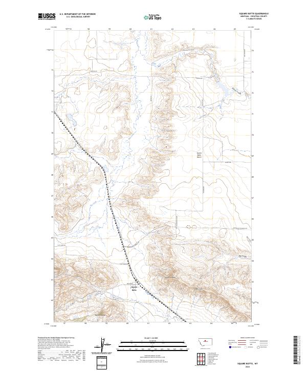
2024 Map of Square Butte
USGS Topo · Published 2024About this map
Square Butte rises prominently above the high plains of Chouteau County, anchoring a landscape defined by dramatic geological formations and deep coulees. The map details the massive Square Butte Bench to the north and the striking Chalk Cliffs to the southeast, illustrating how the regional topography dictates movement and land use. Waterways like Flat Creek and Phantom Coulee cut through the terrain, providing essential drainage for the surrounding ranchlands. The network of local routes, including Square Butte Bench Rd and the curiously named Photography Way, reflects the modern infrastructure supporting this rural Montana community. This survey offers a clear view of the complex land divisions between Antelope Butte and Buckskin Butte, where the interplay of named coulees and creek beds creates a distinctively western map pattern centered on these volcanic and sedimentary landmarks.
Find a feature on this map
25 named features on this map. Tap any name to fly to it.
Don’t see what you’re looking for? This feature index may not catch every label — zoom into the map to look around manually.
Map Details
Editions of this 2024 Square Butte Map
This is the sole edition of this map. No revisions or reprints were ever made.
Other maps of this area

1890 · Fort Benton
USGS Topo · 1:250,000

1892 · Fort Benton
USGS Topo · 1:250,000

1897 · Fort Benton
USGS Topo · 1:250,000

1954 · Great Falls
USGS Topo · 1:250,000

1957 · Great Falls
USGS Topo · 1:250,000

1972 · Square Butte SE
USGS Topo · 1:24,000

1972 · Square Butte
USGS Topo · 1:24,000
1972 · Dammel Reservoir
USGS Topo · 1:24,000
1972 · Square Butte NE
USGS Topo · 1:24,000
1972 · Geraldine NE
USGS Topo · 1:24,000