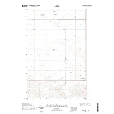
2020 Map of Square Butte SE
USGS Topo · Published 2020About this map
Square Butte Bench dominates the central landscape of this Chouteau County region, a high landform defined by its surrounding drainages. To the north and south, the terrain falls away into a series of seasonal watercourses including Cut Bank Coulee, Panton Coulee, and the larger Big Coulee at the southern edge. This area reflects a classic Montana ranching and agricultural pattern, where roads often follow section lines or the contours of the bench, such as Square Butte Bench Rd and Shine Lake Rd. Local heritage is anchored by the Square Butte Bench Cem and the Owen Bros Airport, suggesting a landscape of long-standing family operations. The presence of Steele Lake Coulee in the east further illustrates the complex erosion patterns that have shaped this high-plains environment.
Find a feature on this map
22 named features on this map. Tap any name to fly to it.
Don’t see what you’re looking for? This feature index may not catch every label — zoom into the map to look around manually.
Map Details
Editions of this 2020 Square Butte SE Map
This is the sole edition of this map. No revisions or reprints were ever made.
Other maps of this area

1890 · Fort Benton
USGS Topo · 1:250,000

1892 · Fort Benton
USGS Topo · 1:250,000

1897 · Fort Benton
USGS Topo · 1:250,000

1953 · Last Chance Bench
USGS Topo · 1:24,000

1954 · Great Falls
USGS Topo · 1:250,000

1954 · Lewistown
USGS Topo · 1:250,000

1957 · Great Falls
USGS Topo · 1:250,000

1959 · Lewistown
USGS Topo · 1:250,000

1972 · Square Butte SE
USGS Topo · 1:24,000

1972 · Square Butte
USGS Topo · 1:24,000