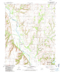
1985 Map of Squaw Creek
USGS Topo · Published 1985About this map
The Canadian River winds through the southwestern corner of this Oklahoma landscape, defining the topography near the border of Blaine County. The 1980s terrain is heavily marked by energy exploration, with numerous Oil Wells and a Gas Well scattered across the uplands. Local history and genealogy are well-represented by several rural burial grounds, including Whirlwind Cem, Emmanuel Cem, and Etna Cem, the latter situated near the Etna Ch. To the south, the landscape shifts toward recreation and conservation at American Horse Lake and the surrounding American Horse Lake State Hunting and Fishing Area. Tributaries such as Bear Creek and Squaw Creek drain the surrounding heights, which are identified by family or regional names like Kennedy, Dixon, and Logan.
Find a feature on this map
16 named features on this map. Tap any name to fly to it.
Don’t see what you’re looking for? This feature index may not catch every label — zoom into the map to look around manually.
Map Details
Editions of this 1985 Squaw Creek Map
This is the sole edition of this map. No revisions or reprints were ever made.
Other maps of this area

1942 · Geary
USGS Topo · 1:62,500

1955 · Clinton
USGS Topo · 1:250,000

1957 · Clinton
USGS Topo · 1:250,000

1964 · Oakwood
USGS Topo · 1:62,500

1964 · Weatherford
USGS Topo · 1:62,500

1972 · Watonga
USGS Topo · 1:24,000

1979 · Greenfield
USGS Topo · 1:24,000
1979 · Bridgeport
USGS Topo · 1:24,000
1985 · Weatherford
USGS Topo · 1:24,000
1985 · Hydro
USGS Topo · 1:24,000