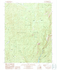
1990 Map of Squaw Dome
USGS Topo · Published 1990About this map
The Sierra National Forest high country is defined by steep granite landforms and a series of high-altitude meadows that supported early seasonal grazing and forestry operations. Prominent landmarks such as Squaw Dome, Jackass Rock, and Fuller Buttes dominate the skyline above the San Joaquin River canyon. The presence of the Mammoth Pool Reservoir and the Minarets FS Station underscores the managed landscape of the late twentieth century, where recreation and utility intersected in the backcountry.
Find a feature on this map
36 named features on this map. Tap any name to fly to it.
Don’t see what you’re looking for? This feature index may not catch every label — zoom into the map to look around manually.
Map Details
Editions of this 1990 Squaw Dome Map
2 editions found
Other maps of this area

1901 · Mt. Lyell
USGS Topo · 1:125,000

1904 · Kaiser
USGS Topo · 1:125,000

1947 · Mariposa
USGS Topo · 1:250,000

1948 · Mariposa
USGS Topo · 1:250,000

1953 · Merced Peak
USGS Topo · 1:62,500

1953 · Devils Postpile
USGS Topo · 1:62,500

1953 · Shuteye Peak
USGS Topo · 1:62,500

1953 · Kaiser Peak
USGS Topo · 1:62,500

1957 · Mariposa
USGS Topo · 1:250,000

1963 · Mariposa
USGS Topo · 1:250,000