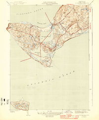
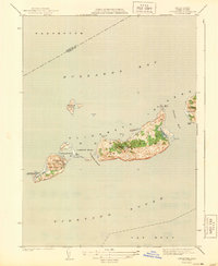
1944 Map of Squibnocket
USGS Topo · Published 1944About this map
Gay Head and the western reaches of Martha's Vineyard are captured here in the early 1940s, a landscape defined by its glacial terminal moraine and intricate coastal geology. The settlement of Chilmark serves as the inland anchor, while small fishing villages like Lobsterville and Menemsha cluster near the tidal inlets. Coastal navigation is guided by the Bay Head Lighthouse, which stands watch over the Vineyard Sound. This era reveals a maritime economy still deeply tied to the natural ponds, with Menemsha Pond and Squibnocket Pond nearly bisecting the island's narrow neck. Further south, the map includes the isolated island of Nomans Land, featuring its own Landing Field. The topography is marked by significant elevations like Peaked Hill and Prospect Hill, which offer views over the dramatic coastal erosion at Zacks Cliffs and Wequobsque Cliffs.
Find a feature on this map
43 named features on this map. Tap any name to fly to it.
Don’t see what you’re looking for? This feature index may not catch every label — zoom into the map to look around manually.
Map Details
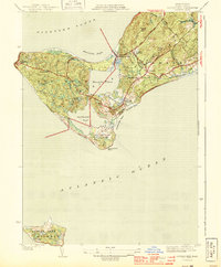
Editions of this 1944 Squibnocket Map
3 editions found
Other maps of this area

1887 · Gay Head
USGS Topo · 1:62,500

1889 · Gay Head
USGS Topo · 1:62,500

1893 · Gay Head
USGS Topo · 1:62,500

1942 · Marthas Vineyard
USGS Topo · 1:125,000

1944 · Tisbury Great Pond
USGS Topo · 1:31,680

1944 · Vineyard Haven
USGS Topo · 1:31,680
1944 · Naushon Island
USGS Topo · 1:31,680
1944 · Squibnocket
USGS Topo · 1:31,680
1944 · Cuttyhunk
USGS Topo · 1:31,680

1947 · Providence
USGS Topo · 1:250,000