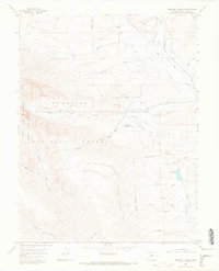
1965 Map of Squirrel Creek
USGS Topo · Published 1968About this map
The high country of Gunnison National Forest is defined here by a network of drainage basins and high alpine terrain in the mid-1960s. Mining activity is evident through the Smith Mine near the northern boundary and the Hinkle Mine situated above Grays Gulch. These operations, along with scattered prospects, point to the region's extraction history, while an Old Railroad Grade running alongside Ohio Creek marks the path of earlier industrial transport.
Find a feature on this map
36 named features on this map. Tap any name to fly to it.
Don’t see what you’re looking for? This feature index may not catch every label — zoom into the map to look around manually.
Map Details
Editions of this 1965 Squirrel Creek Map
4 editions found
Other maps of this area

1888 · Crested Butte
USGS Topo · 1:62,500

1888 · Anthracite
USGS Topo · 1:62,500

1889 · Crested Butte
USGS Topo · 1:62,500

1889 · Anthracite
USGS Topo · 1:62,500

1893 · Anthracite
USGS Topo · 1:62,500

1893 · Crested Butte
USGS Topo · 1:62,500

1894 · Anthracite
USGS Topo · 1:62,500

1954 · Mc Intosh Mountain
USGS Topo · 1:24,000

1954 · West Elk Peak SW
USGS Topo · 1:24,000

1954 · Gunnison
USGS Topo · 1:24,000