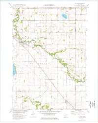
1974 Map of St Clair
USGS Topo · Published 1976About this map
The Le Sueur River carves a winding path through the agricultural heart of McPherson and Le Ray townships in the mid-1970s. This landscape is defined by its sophisticated drainage network, featuring numerous engineered channels such as County Ditch No 26 and County Ditch No 83 that support the surrounding farmsteads. The community of St Clair serves as a local hub along the river, while Pemberton anchors the southern portion of the sheet near the Little Cobb River. Transportation and infrastructure are central to the area's layout, highlighted by the diagonal route of the Chicago Milwaukee St Paul and Pacific railroad. Genealogists will find significant value in the documentation of several local burial sites, including McPherson Cem, St Johns Cem, and the more remote Medo-McPherson Cem.
Find a feature on this map
22 named features on this map. Tap any name to fly to it.
Don’t see what you’re looking for? This feature index may not catch every label — zoom into the map to look around manually.
Map Details
Editions of this 1974 St Clair Map
This is the sole edition of this map. No revisions or reprints were ever made.
Other maps of this area

1950 · Mankato East
USGS Topo · 1:62,500

1951 · Mankato East
USGS Topo · 1:62,500

1953 · Saint Paul
USGS Topo · 1:250,000

1954 · Mason City
USGS Topo · 1:250,000

1957 · Mason City
USGS Topo · 1:250,000

1958 · Mason City
USGS Topo · 1:250,000

1959 · Saint Paul
USGS Topo · 1:250,000

1966 · Janesville
USGS Topo · 1:24,000

1966 · Elysian
USGS Topo · 1:24,000

1967 · Waldorf
USGS Topo · 1:24,000