2023 Map of St. Clair
USGS Topo · Published 2023About this map
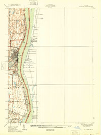
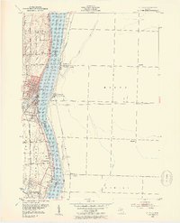
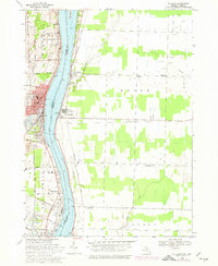
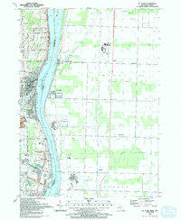
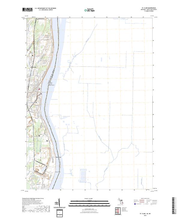
The Saint Clair River serves as the international boundary between the United States and Canada in this riverfront area of St. Clair County. The city of St. Clair sits at the confluence where the Pine River joins the larger waterway, showing a dense street grid that includes North Riverside Avenue and Clinton Avenue. Northward, the landscape transitions into Marysville, with the terrain marked by several drainages such as Jordan Creek and East Branch Jordan Creek. Local history and genealogy researchers will find several well-defined burial grounds, including Saint Marys Cem to the north and Hillside Cem and Rose Hill Cem further south. The map also identifies Saint Clair Middle Ground in the river and the smaller riverside communities of Hawthorne and Recors Point.
Find a feature on this map
72 named features on this map. Tap any name to fly to it.
Don’t see what you’re looking for? This feature index may not catch every label — zoom into the map to look around manually.
Map Details
Editions of this 2023 St. Clair Map
This is the sole edition of this map. No revisions or reprints were ever made.
Historical Maps of East China Charter Township Through Time
6 maps found