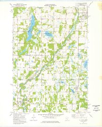
1974 Map of St Francis
USGS Topo · Published 1976About this map
The Rum River winds through the heart of this mid-1970s landscape, serving as a primary geographic anchor for the townships of Stanford, Bradford, Athens, and Oak Grove. This era shows a community defined by its water resources and conservation efforts, seen in the expansive Marget Lake State Wildlife Management Area and Bethel State Wildlife Management Area. The settlement of St Francis anchors the southwest corner, while the village of Isanti and the Burlington Northern railroad corridor mark the northeastern reaches.
Find a feature on this map
46 named features on this map. Tap any name to fly to it.
Don’t see what you’re looking for? This feature index may not catch every label — zoom into the map to look around manually.
Map Details
Editions of this 1974 St Francis Map
This is the sole edition of this map. No revisions or reprints were ever made.
Other maps of this area

1916 · St. Francis
USGS Topo · 1:62,500

1919 · St. Francis
USGS Topo · 1:62,500

1953 · Stillwater
USGS Topo · 1:250,000

1955 · Isanti
USGS Topo · 1:62,500

1955 · Stillwater
USGS Topo · 1:250,000

1958 · Stillwater
USGS Topo · 1:250,000

1961 · Bradford
USGS Topo · 1:24,000

1961 · Cambridge
USGS Topo · 1:62,500

1961 · Wyanett
USGS Topo · 1:24,000

1961 · Dalbo
USGS Topo · 1:62,500