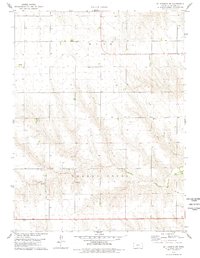
1978 Map of St Francis SW
USGS Topo · Published 1978About this map
Cherry Creek meanders through this agricultural landscape in the High Plains of western Kansas, defining the local drainage and topography in the late 1970s. The community structure of the Wano township is anchored by historical landmarks such as Salem Ch and the nearby Salem Cem, which serve as critical touchpoints for genealogists tracing family roots in Cheyenne County. The map details a rural economy focused on land use, indicated by a local Sandpit and scattered industrial markers like a Drill Hole. This survey provides a precise record of the section lines and small-scale infrastructure that supported the farming communities of the region during a period of steady rural development.
Find a feature on this map
7 named features on this map. Tap any name to fly to it.
Don’t see what you’re looking for? This feature index may not catch every label — zoom into the map to look around manually.
Map Details
Editions of this 1978 St Francis SW Map
This is the sole edition of this map. No revisions or reprints were ever made.
Other maps of this area

1942 · St. Francis
USGS Topo · 1:62,500

1943 · St. Francis
USGS Topo · 1:62,500

1950 · Bonny Reservoir
USGS Topo · 1:62,500

1951 · St Francis
USGS Topo · 1:62,500

1952 · St Francis 3
USGS Topo · 1:62,500

1954 · Limon
USGS Topo · 1:250,000

1954 · Goodland
USGS Topo · 1:250,000

1956 · Goodland
USGS Topo · 1:250,000

1957 · Limon
USGS Topo · 1:250,000

1957 · Goodland
USGS Topo · 1:250,000