
1956 Map of St. George NE
USGS Topo · Published 1956About this map
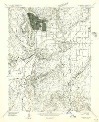
The community of Washington anchors the southeastern corner of this mid-century survey, its gridded streets bounded by the St George City Boundary. To the north, the landscape rises into the high country of the Dixie National Forest, where the Cottonwood Guard Station stands near the headwaters of Mill Creek. The terrain is defined by dramatic volcanic and sandstone features, including the stark Middleton Black Ridge and the Red Hills. Natural water sources like Green Spring, Gray Spring, and Miller Spring suggest the critical importance of water management in this arid region, further evidenced by the Black Knolls Reservoir and an extensive pipeline network. Industrial activity is represented by a Gravel Pit located near the Buckskin formation, while local history is marked by the presence of a Cem on the outskirts of the primary settlement.
Find a feature on this map
30 named features on this map. Tap any name to fly to it.
Don’t see what you’re looking for? This feature index may not catch every label — zoom into the map to look around manually.
Map Details
Editions of this 1956 St. George NE Map
This is the sole edition of this map. No revisions or reprints were ever made.
Other maps of this area

1885 · St. George
USGS Topo · 1:250,000

1891 · St. George
USGS Topo · 1:250,000

1953 · Cedar City
USGS Topo · 1:250,000

1954 · La Verkin 3 NW
USGS Topo · 1:24,000

1954 · La Verkin 3 SW
USGS Topo · 1:24,000

1954 · St. George
USGS Topo · 1:62,500

1954 · Hurricane
USGS Topo · 1:62,500
1956 · St. George SE
USGS Topo · 1:24,000

1956 · St. George NW
USGS Topo · 1:24,000
1956 · St. George SW
USGS Topo · 1:24,000