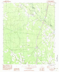
1982 Map of St. George SW
USGS Topo · Published 1983About this map
The Edisto River snakes along the boundary between Dorchester and Colleton counties, anchoring a landscape defined by wetlands and rural outposts in the early 1980s. The Seaboard Coast Line Railroad cuts a straight path through the territory, running parallel to several sections of dismantled RR grade that reflect shifting transportation priorities in the South Carolina Lowcountry.
Find a feature on this map
21 named features on this map. Tap any name to fly to it.
Don’t see what you’re looking for? This feature index may not catch every label — zoom into the map to look around manually.
Map Details
Editions of this 1982 St. George SW Map
This is the sole edition of this map. No revisions or reprints were ever made.
Other maps of this area

1918 · Walterboro
USGS Topo · 1:62,500

1919 · Cummings
USGS Topo · 1:62,500

1919 · Lodge
USGS Topo · 1:62,500

1920 · Lodge
USGS Topo · 1:48,000

1920 · St. George
USGS Topo · 1:48,000

1921 · Lodge
USGS Topo · 1:62,500

1921 · St. George
USGS Topo · 1:62,500

1943 · Lodge
USGS Topo · 1:62,500

1943 · Orangeburg
USGS Topo · 1:125,000

1943 · Cummings
USGS Topo · 1:62,500