1986 Map of St. George
USGS Topo · Published 1987About this map
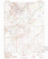
St George centers this mid-1980s topographical study, revealing the city's residential and institutional layout before the massive expansion of the late 20th century. The urban grid is clearly defined, featuring the Dixie Jr College campus and the local Cem near the city center. The geography is dictated by the volcanic and sedimentary formations of West Black Ridge and Middleton Black Ridge, which hem in the development. To the south, the newer suburbs of Bloomington and Bloomington Hills appear along the banks of the Virgin River. The map captures a critical transition for the region, showing the Municipal Airport and the Santa Clara Canal alongside traditional agricultural areas like the St George Fields and Washington Fields. The landscape descends from the Red Hills into Big Valley, crossing the boundary into Mohave County.
Find a feature on this map
34 named features on this map. Tap any name to fly to it.
Don’t see what you’re looking for? This feature index may not catch every label — zoom into the map to look around manually.
Map Details
Editions of this 1986 St. George Map
2 editions found
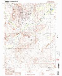
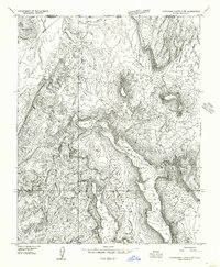
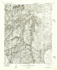
Other maps of this area

1885 · St. George
USGS Topo · 1:250,000

1886 · Mt. Trumbull
USGS Topo · 1:250,000

1891 · St. George
USGS Topo · 1:250,000

1892 · Mt. Trumbull
USGS Topo · 1:250,000

1953 · Cedar City
USGS Topo · 1:250,000

1953 · Grand Canyon
USGS Topo · 1:250,000
1954 · Hurricane Cliffs 2 NW
USGS Topo · 1:24,000

1954 · La Verkin 3 NW
USGS Topo · 1:24,000
1954 · Wolf Hole Mtn. NW
USGS Topo · 1:24,000

1954 · La Verkin 3 SW
USGS Topo · 1:24,000