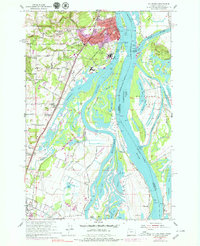
1954 Map of St. Helens
USGS Topo · Published 1979About this map
St. Helens and its river-dependent neighbors occupy this reach of the lower Columbia River during a period of mid-century industrial and residential expansion. The map details the complex shoreline where the river meets the Multnomah Channel, surrounding large landmasses like Bachelor Island and the northern tip of Sauvie Island. These islands, defined by an intricate network of sloughs and lakes such as Sturgeon Lake and Cunningham Slough, highlight the delta-like environment before further modern development. Inland, the transition from the riverfront to the upland is marked by scattered schools like McBride Sch and Bachelor Flat School, along with early suburban growth in Columbia Heights. The presence of the Burlington Northern railroad and the Columbia River Hwy underscores the importance of this corridor for regional transport between Portland and the coast. Large-scale features like the Columbia County Airport and various quarries indicate the area's diversifying economy beyond traditional river commerce.
Find a feature on this map
80 named features on this map. Tap any name to fly to it.
Don’t see what you’re looking for? This feature index may not catch every label — zoom into the map to look around manually.
Map Details
Editions of this 1954 St. Helens Map
Other maps of this area

1897 · Portland
USGS Topo · 1:62,500

1905 · Portland
USGS Topo · 1:62,500

1915 · Hillsboro
USGS Topo · 1:62,500

1918 · Hillsboro
USGS Topo · 1:62,500

1922 · St. Helens
USGS Topo · 1:62,500

1940 · Hillsboro
USGS Topo · 1:62,500

1940 · Portland
USGS Topo · 1:62,500

1940 · La Center
USGS Topo · 1:62,500

1941 · St Helens
USGS Topo · 1:62,500

1943 · St Helens
USGS Topo · 1:62,500