
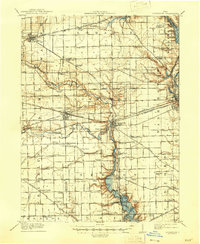
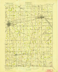
1908 Map of St. Henry
USGS Topo · Published 1944About this map
St Henry and the surrounding townships of Mercer and Darke counties define this agrarian landscape at the dawn of the twentieth century. The topography is shaped by significant water systems, including the headwaters of the Wabash River and Mississinewa River, alongside engineered drainages like Darlinghaus Ditch and Vandenbush Ditch. In the north, the shoreline of Grand Lake reaches toward Monte Zuma, while the Treaty Line and Boundary Line cut across the grid of section lines, reflecting early Ohio land divisions.
Find a feature on this map
58 named features on this map. Tap any name to fly to it.
Don’t see what you’re looking for? This feature index may not catch every label — zoom into the map to look around manually.
Map Details
Editions of this 1908 St. Henry Map
This is the sole edition of this map. No revisions or reprints were ever made.
Other maps of this area

1909 · Loramie
USGS Topo · 1:62,500

1911 · Berne
USGS Topo · 1:48,000

1911 · Loramie
USGS Topo · 1:62,500

1911 · Spencerville
USGS Topo · 1:62,500
1911 · Covington
USGS Topo · 1:62,500

1914 · Celina
USGS Topo · 1:62,500

1915 · Fort Recovery
USGS Topo · 1:48,000

1916 · Winchester
USGS Topo · 1:48,000
1918 · Winchester
USGS Topo · 1:62,500

1918 · Fort Recovery
USGS Topo · 1:62,500