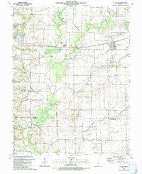
1991 Map of St. Jacob
USGS Topo · Published 1991About this map
The agricultural plains of St Jacob and Troy are defined by the winding course of Silver Creek and its tributaries, including East Fork Silver Creek and Little Silver Creek. This 1991 survey illustrates a landscape deeply rooted in family history, evidenced by a high density of small burial grounds such as Hagler Cem, Gilead Cem, and Lagenwalter Cem scattered among the farmsteads. The transition from traditional rail transport to modern aviation is visible through the Old Railroad Grade passing through the center of the sheet and the presence of the Metro-East Airport. Notable landmarks such as Emerald Mound and Terrapin Ridge punctuate the drainage basins, while the village of St Jacob centers around St James Ch and its Township Park. Resource extraction is noted by several Oil Wells and a Gas Well in the eastern sections of the quadrangle.
Find a feature on this map
83 named features on this map. Tap any name to fly to it.
Don’t see what you’re looking for? This feature index may not catch every label — zoom into the map to look around manually.
Map Details
Editions of this 1991 St. Jacob Map
This is the sole edition of this map. No revisions or reprints were ever made.
Other maps of this area

1906 · Breese
USGS Topo · 1:62,500

1907 · Breese
USGS Topo · 1:62,500

1907 · Belleville
USGS Topo · 1:62,500

1927 · Edwardsville
USGS Topo · 1:62,500

1932 · Edwardsville
USGS Topo · 1:62,500

1935 · Lebanon
USGS Topo · 1:24,000

1937 · Collinsville
USGS Topo · 1:24,000

1937 · O'Fallon
USGS Topo · 1:24,000

1937 · New Douglas
USGS Topo · 1:48,000

1944 · New Douglas
USGS Topo · 1:62,500