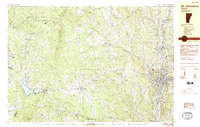
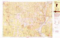
1983 Map of St. Johnsbury
USGS Topo · Published 1983This historical map portrays the area of St. Johnsbury in 1983, primarily covering Caledonia County as well as portions of Washington County. Featuring a scale of 1:25000, this map provides a highly detailed snapshot of the terrain, roads, buildings, counties, and historical landmarks in the St. Johnsbury region at the time. Published in 1983, it is one of 2 known editions of this map due to revisions or reprints.
Find a feature on this map
68 named features on this map. Tap any name to fly to it.
Don’t see what you’re looking for? This feature index may not catch every label — zoom into the map to look around manually.
Map Details
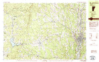
Editions of this 1983 St. Johnsbury Map
2 editions found
Historical Maps of Coles Corner Through Time
9 maps found

1938 St. Johnsbury
Caledonia County, VT

1943 St. Johnsbury
Caledonia County, VT
1949 St. Johnsbury
Caledonia County, VT
1967 Concord
Caledonia County, VT
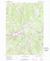
1973 Groton
Caledonia County, VT
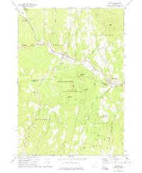
1983 Barnet
Caledonia County, VT
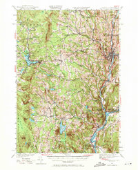
1983 St. Johnsbury
Caledonia County, VT
1986 Stannard
Caledonia County, VT
1988 Burke Mountain
Caledonia County, VT