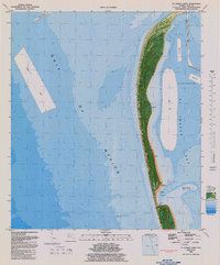
1982 Map of St. Joseph Point
USGS Topo · Published 1983About this map
St Joseph Peninsula State Park dominates this 1982 orthophotomap, showing the narrow coastal barrier between the Gulf of Mexico and St Joseph Bay. The map integrates aerial photography with bathymetric data, detailing the underwater topography of the bay and the fluctuating shoreline at St Joseph Pt. Significant navigational and environmental features are visible, including the deep pocket of Shark Hole and various spoil areas. Marine facilities and landmarks like Eagle Harbor, multiple Boat Ramps, and a labeled Dump Site reflect the human activity and management of this coastal preserve during the early 1980s. The survey captures a dynamic environment where the landscape is marked by an Area subject to frequent change, illustrating the constant shift of sands along the Florida panhandle.
Find a feature on this map
13 named features on this map. Tap any name to fly to it.
Don’t see what you’re looking for? This feature index may not catch every label — zoom into the map to look around manually.
Map Details
Editions of this 1982 St. Joseph Point Map
2 editions found
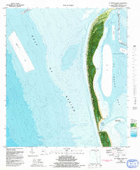
Other maps of this area

1943 · St Joseph Spit
USGS Topo · 1:31,680

1943 · Port St. Joe
USGS Topo · 1:31,680

1943 · Cape San Blas
USGS Topo · 1:31,680

1943 · Overstreet
USGS Topo · 1:31,680

1943 · Crooked Island
USGS Topo · 1:31,680

1944 · Beacon Hill
USGS Topo · 1:31,680

1945 · St Joseph Point
USGS Topo · 1:31,680

1949 · Apalachicola
USGS Topo · 1:250,000
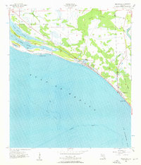
1956 · Beacon Hill
USGS Topo · 1:24,000
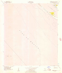
1956 · Crooked Island
USGS Topo · 1:24,000