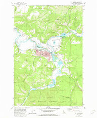
1981 Map of St Maries
USGS Topo · Published 1982About this map
The confluence of the St Joe River and the St Maries River anchors this North Idaho landscape, where the town of St Maries serves as a hub for both river and rail transport. The local economy and infrastructure are evidenced by the Industrial Railroad, a large Grain Elevator, and numerous Gravel Pits scattered along the valley floor. Cultural and civic life is centered around the Fairgrounds, the St Maries Cemetery, and the Mullan Trail Hist Mon, which marks the path of the historic military road through the region.
Find a feature on this map
51 named features on this map. Tap any name to fly to it.
Don’t see what you’re looking for? This feature index may not catch every label — zoom into the map to look around manually.
Map Details
Editions of this 1981 St Maries Map
This is the sole edition of this map. No revisions or reprints were ever made.
Other maps of this area

1950 · Rochat Peak
USGS Topo · 1:24,000

1952 · Rochat Peak
USGS Topo · 1:24,000

1955 · Spokane
USGS Topo · 1:250,000

1957 · St. Maries
USGS Topo · 1:62,500

1957 · Emida
USGS Topo · 1:62,500

1957 · St. Joe
USGS Topo · 1:62,500

1958 · Spokane
USGS Topo · 1:250,000

1961 · Fernwood
USGS Topo · 1:62,500

1981 · St Maries
USGS Topo · 1:100,000
1981 · Medimont
USGS Topo · 1:24,000