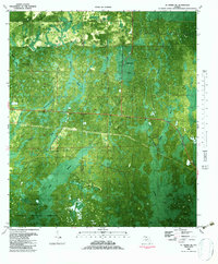
1982 Map of St. Marks NE
USGS Topo · Published 1983About this map
St Marks National Wildlife Refuge dominates the southern landscape of this 1980s orthophotomap, where the border between Wakulla and Jefferson Counties cuts through a dense, hydrologically complex wilderness. The terrain is defined by its karst topography, featuring numerous specialized drainage points such as Bear Bay Sink, Indian Camp Sink, and Pinhook Sinks. These natural depressions, alongside named water bodies like Jake Hole and Big Rock Sink, reveal the underlying limestone geology that shapes the Gulf Coastal Lowlands.
Find a feature on this map
19 named features on this map. Tap any name to fly to it.
Don’t see what you’re looking for? This feature index may not catch every label — zoom into the map to look around manually.
Map Details
Editions of this 1982 St. Marks NE Map
This is the sole edition of this map. No revisions or reprints were ever made.
Other maps of this area

1954 · Sprague Island
USGS Topo · 1:24,000

1954 · Cody
USGS Topo · 1:24,000

1954 · Woodville
USGS Topo · 1:24,000

1954 · St. Marks NE
USGS Topo · 1:24,000

1954 · St. Marks
USGS Topo · 1:24,000

1954 · Cobb Rocks
USGS Topo · 1:24,000

1954 · Valdosta
USGS Topo · 1:250,000

1954 · Tallahassee
USGS Topo · 1:250,000

1955 · Snipe Island
USGS Topo · 1:24,000

1955 · Nutall Rise
USGS Topo · 1:24,000