Loading...
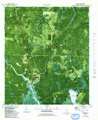
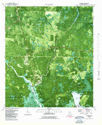
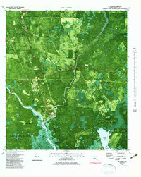
Loading map...1982 Map of St. Marks
USGS Topo · Published 1983About this map
The convergence of the St Marks River and the Wakulla River anchors this coastal Florida landscape, where deep-seated history meets the conservation lands of the St Marks National Wildlife Refuge. The settlement of St Marks sits at this maritime junction, featuring the San Marcos De Apalache State Museum and an extensive Old Railroad Grade that speaks to the area's early transit corridors. Further inland, the community of Newport is defined by its proximity to Newport Spring and Brewer Spring.
Find a feature on this map
60 named features on this map. Tap any name to fly to it.
Don’t see what you’re looking for? This feature index may not catch every label — zoom into the map to look around manually.
Map Details
Date Portrayed1982
Date Published1983
PublisherU.S. Geological Survey
Map TypeTopographic
Scale1:24,000
Physical Dimensions23 x 27.9 inches
Editions of this 1982 St. Marks Map
3 editions found
Historical Maps of Saint Marks Through Time
No other maps found
Featured Locations
Source Details
SourceU.S. Geological Survey
CopyrightPublic Domain