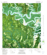
1979 Map of St. Marys
USGS Topo · Published 1980About this map
St. Marys sits at the heart of this coastal borderland, where the winding St. Marys River serves as a natural boundary between Georgia and Florida. This late-1970s orthophotomap emphasizes the intricate network of tidal waterways, including the Jolly River and North River, which carve through a landscape of dense marsh and maritime forest. The urban grid of the town is well-defined, showing civic infrastructure like Gilman Hospital and the St. Marys Airport alongside historical spiritual centers such as Oak Grove Cem and St. Marys Ch.
Find a feature on this map
58 named features on this map. Tap any name to fly to it.
Don’t see what you’re looking for? This feature index may not catch every label — zoom into the map to look around manually.
Map Details
Editions of this 1979 St. Marys Map
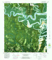
2 editions found
Other maps of this area

1918 · St Marys
USGS Topo · 1:62,500

1918 · Cumberland Island
USGS Topo · 1:62,500

1918 · Kingsland
USGS Topo · 1:62,500

1919 · Fernandina
USGS Topo · 1:62,500

1919 · St Marys
USGS Topo · 1:62,500

1930 · Cumberland Island
USGS Topo · 1:62,500

1944 · Fernandina
USGS Topo · 1:62,500

1945 · Cumberland Island
USGS Topo · 1:62,500

1948 · Jacksonville
USGS Topo · 1:250,000

1957 · Jacksonville
USGS Topo · 1:250,000