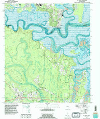
1993 Map of St Marys
USGS Topo · Published 1995About this map
St Marys serves as the focal point of this coastal survey, where the St Marys River carves a deep, winding boundary between Georgia and Florida. The town's historic grid is clearly visible, anchored by St Marys Sch, Gilman Hospital, and the long-established Oak Grove Cem. To the east, the map detail extends into the marshes of the Cumberland Island National Seashore and the Jolly River, showing the intricate tidal network of Tiger Basin and Tiger Island.
Find a feature on this map
48 named features on this map. Tap any name to fly to it.
Don’t see what you’re looking for? This feature index may not catch every label — zoom into the map to look around manually.
Map Details
Editions of this 1993 St Marys Map
2 editions found
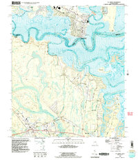
Other maps of this area

1918 · St Marys
USGS Topo · 1:62,500

1918 · Cumberland Island
USGS Topo · 1:62,500

1918 · Kingsland
USGS Topo · 1:62,500

1919 · Fernandina
USGS Topo · 1:62,500

1919 · St Marys
USGS Topo · 1:62,500

1930 · Cumberland Island
USGS Topo · 1:62,500

1944 · Fernandina
USGS Topo · 1:62,500

1945 · Cumberland Island
USGS Topo · 1:62,500

1948 · Jacksonville
USGS Topo · 1:250,000

1957 · Jacksonville
USGS Topo · 1:250,000