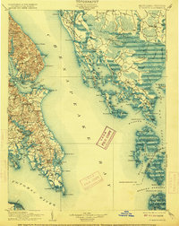
1906 Map of St. Marys
USGS Topo · Published 1915About this map
St. Marys and the surrounding Chesapeake tidewater appear in detail during this era of coastal navigation and rural settlement. The survey illustrates the deep integration of water and land, where the Patuxent River and Potomac River frame a landscape of numerous points and necks. Key maritime landmarks like Cove Point L.H. and Drum Point L.H. guide traffic toward established landing sites such as Pearson and Solomons.
Find a feature on this map
134 named features on this map. Tap any name to fly to it.
Don’t see what you’re looking for? This feature index may not catch every label — zoom into the map to look around manually.
Map Details
Editions of this 1906 St. Marys Map
4 editions found

Other maps of this area

1892 · Leonardtown
USGS Topo · 1:62,500

1892 · Drum Point
USGS Topo · 1:62,500

1892 · Prince Frederick
USGS Topo · 1:62,500

1892 · Piney Point
USGS Topo · 1:62,500

1893 · Sharps Island
USGS Topo · 1:62,500

1894 · Piney Point
USGS Topo · 1:62,500

1894 · Point Lookout
USGS Topo · 1:62,500

1895 · Prince Frederick
USGS Topo · 1:62,500

1895 · Leonardtown
USGS Topo · 1:62,500

1895 · Nomini
USGS Topo · 1:125,000